 (7 Kb gif)
Welcome to Wellington, my home town. This page comprises a quick set of photos taken by myself for showing to my overseas friends so that they would see what home was like. Having visited the friends now, and received a satisfying number of envious remarks, I decided it was time to put the photographs to some other use.
After checking the city council's effort I decided to see if I could do better. Before they updated their pages they consisted of some fairly poorly digitised shots grabbed from a video camera. (That was around Mid 1995, since then they have produced a much better effort.) Mine aren't coming from a much better source. These were all taken with my little Olympus fully automatic 35mm camera and scanned in.
I am not a photography expert in any way, shape or form. So these pictures tend to be ones that simply looked aestheticly pleasing to me.
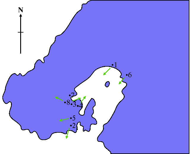
Well enough intro, here is a rough map. The map gives you an idea of the layout of the Wellington region and where I took the photographs. Please note the positions are not terribly accurate as I spaced some of the points out for clarity of reading. Below the map is a legend linking the map to the photos.
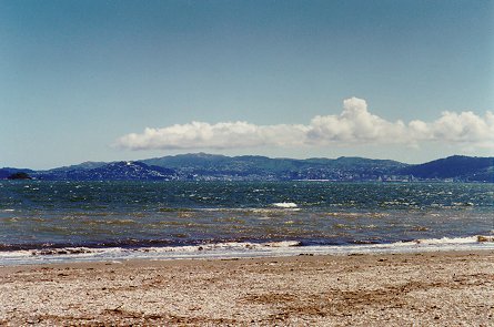
This is the Petone beach, looking back towards the city proper across the harbour. Behind me is the Hutt valley, some of the flatest land available in Wellington. Most of us have to cope with hills... The Mount Victoria view is basically looking back towards where this photo was taken so you might like to look at that next to see how flat the Hutt can be.
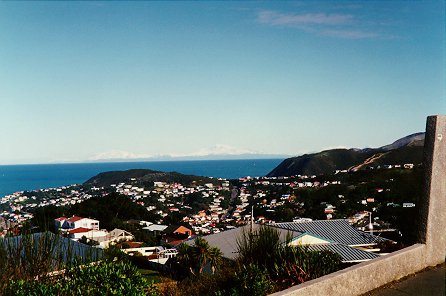
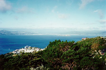
This is the view from a little further down the road from where I live. As I am at the south end of the city this view overlooks the Cook Strait and, fading into the blue of the sky, the South Island is visible. Given that Wellington doesn't get much snow, about twice in twenty years, this view is a good way to get a dose of snow.
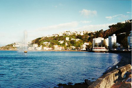
This is Oriental Parade, a suburb right down on the harbour front in a very sheltered spot. The centre of town is five to ten minutes walk away, depending on how fast you walk. A slightly miraculous event is that I managed to catch the fountain in it's full glory. The fountain is something of a bemusement to me as I have never yet been able to divine exactly when it turns itself on and off.
I am informed that it is an automatic system that runs it. But it doesn't seem to be strongly wind, time or tide related. Maybe one day I will figure it out. (As an aside I have been informed that it is indeed wind related. Something I thought I had ruled out. So much for my powers of observation.) The hillside the houses are arrayed up is actually Mount Victoria and the next shot comes from the top of it.
Welcome to the top of Mount Vic! Here I am, once again, looking across the harbour. This time towards Petone and the Hutt Valley from Wellington city proper. Oriental Parade is to my left and down a fair bit.
Up the top is a memorial to Greg Byrd, a defunct memorial cannon and an observation point. From there the majority of Wellington can be surveyed, so it is a good spot to stop by on a summer afternoon and enjoy the view.
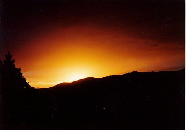
Alright, strictly speaking this isn't really of anything scenic in Wellington. Well it is, namely the view from my bedroom window, but it doesn't really show anything of the city layout. I include it simply because I wanted to show you what a typical sunset is like. I have a better sunset shot than this one, but unfortunately someone in Chicago liked it so much that they asked to keep the photo.
Until I get the inclination to re-print the photo from the negatives this is the best I can do.
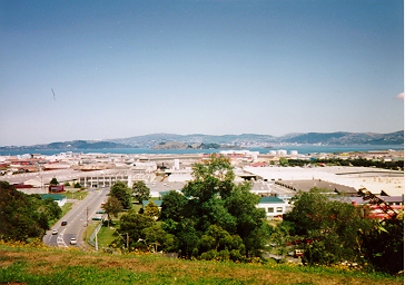
Here is one of the reasons I like working where I do, the view. This overlooks the Petone foreshore a bit and the photo I took from the Petone beach is located up in the hard right of this photo.
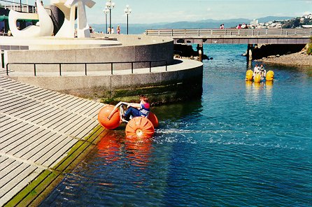
Here is one of the more fun things to do in the summer, water trikes! In this photo a friend and I are trying to make a break up the ramp for the road with the trike. As you can see we didn't get it very far up ramp. Perhaps with practice...
The lagoon we are messing about in is located down by the harbour and actually has a small channel that connects it with the harbour proper, seen behind the yellow water trike in the background. At the time we did try taking the trike into the harbour to see if we could chase the inter-island ferry. Much to our regret we found steering and power problems that prevented us from getting far. So we came back and tried the ramp instead.
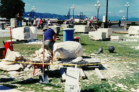
Now this is part of the program the city council puts on in the summer. The park is Frank Kitt park and the photo was taken just a little to the left of the above one. Here a stone carving contest in underway with the person in the centre of the shot using an axe on the rock.
The eventual wining entry of the contest was donated to Victoria University and is, presumably, on display on the campus somewhere.
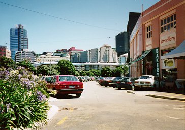
Here, taken while stuck at the lights, is our new Town Hall. (the concrete hat affair in the centre of the shot, past the trees.) Personally I think the thing is ugly, and prefer the old Town Hall for looks, grace and style externally. However on the inside, in the main auditorium, the acoustics are good - so perhaps it was worth having.
Maybe.
Thus ends this quicky look round Wellington. I hope now you can see why I love the city and it's environs.
 (36 Kb jpeg)
 (34 Kb jpeg)
 (40 Kb jpeg)
 (34 Kb jpeg)
 (9 Kb jpeg)
 (86 Kb jpeg)
 (52 Kb jpeg)
 (58 Kb jpeg)
 (31 Kb jpeg)